S2000 Series

Matrixens S2000

Long-range slope monitoring. 2000 m range, 0.5° angular resolution, solid-state MIMO.

Range
2000 m
Accuracy
0.1–1 mm
Weight
4 kg

Key Features

Extended Range

2000 m operational range with 0.5° angular resolution. Monitor entire large-scale slopes from a single vantage point.

Sub-mm Precision

Interferometric phase measurement delivers 0.1–1 mm accuracy across the full range.

All-weather 24/7

Microwave penetrates rain, snow, fog, and dust. Continuous autonomous monitoring.

Zero Targets Required

No corner reflectors needed. MIMO digital beamforming enables target-free measurement.

Wide Coverage

≥100° azimuth, ≥40° elevation FOV. Cover complex terrain from a single deployment position.

Low Power

15 W average consumption. Solar-ready for fully autonomous off-grid operation.

Technical Specifications

Range
2000 m
Accuracy
0.1–1 mm
Range Resolution
0.15 m
Angular Resolution
0.5°
Azimuth FOV
≥100°
Elevation FOV
≥40°
Data Cycle
45 s
Dimensions
320×220×65 mm
Weight
4 kg
Avg. Power
15 W
IP Rating
IP65
Operating Temp.
−40 ~ +65 °C
Data Interface
Ethernet / 4G
Applications
Long-range highway/railway slopes, large open-pit mines, tailings dams

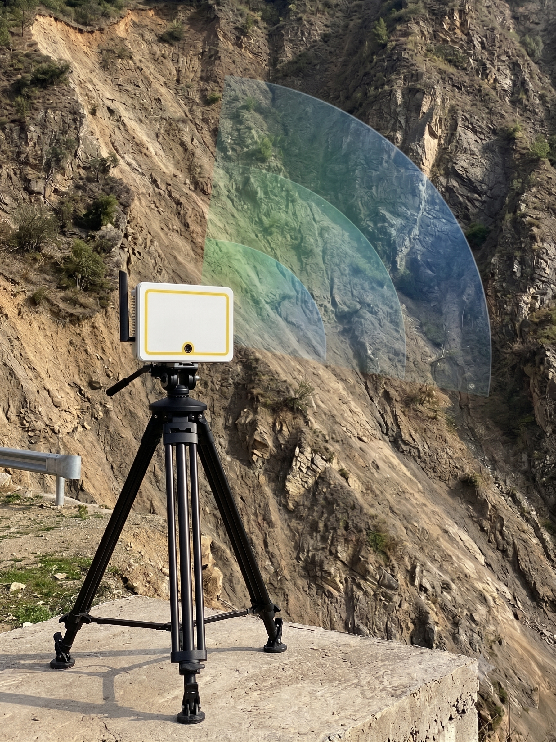
Typical Applications

The S2000 is designed for large-scale slope monitoring where extended range and wide coverage are critical:

  • Large Open-Pit Mines — Monitor entire pit walls and benches from safe distances with 2000 m coverage.
  • Tailings Dams — Comprehensive dam face monitoring with wide FOV coverage from limited vantage points.
  • Mountainous Highways — Long-range monitoring of extensive slope sections along mountain highways.
  • Landslide-prone Regions — Regional-scale deformation monitoring for early warning systems.

Ready to Deploy?

Contact our team for a customized monitoring solution and on-site demonstration.

info@matrixens.com